 Say
“Surigao”, and, chances are, the first thing that would probably run through an
incorrigible tourist’s mind are the wild, wind-swept and wickedly surprising
escapades guaranteed to give anyone a good dose of sun, sea and sand in the
so-called “City of Island Adventures”, a title that fits Surigao del Norte’s
capital to a tee.
Say
“Surigao”, and, chances are, the first thing that would probably run through an
incorrigible tourist’s mind are the wild, wind-swept and wickedly surprising
escapades guaranteed to give anyone a good dose of sun, sea and sand in the
so-called “City of Island Adventures”, a title that fits Surigao del Norte’s
capital to a tee.
 Say
“Surigao”, and, chances are, the first thing that would likely whet an
insatiable foodie’s appetite are the fresh catch of fish, crabs, lobsters and
prawns cooked and served in a variety of ways—grilled, fried, boiled, steamed,
baked and what have you—by restaurants in one of Mindanao’s renowned seafood
capitals.
Say
“Surigao”, and chances are, the first thing that would perhaps tickle an
impassioned historian’s imagination are the treasure trove of precious
historical and cultural finds just waiting to be rediscovered in one of
Philippines’ little known yet most important enclaves of history, culture and
the arts.
I’m
a bit of the three—incorrigible tourist, insatiable foodie and impassioned
(read: wannabe) historian—and those thoughts crossed my mind when I learned I
was one of the delegates to a Mindanao-wide corporate event in Surigao. I’ve
never been there so imagine how surprised and delighted I was to know I’m bound
for the city.
 |
| Surigao's giant crabs |
 Nestled
in the northeasternmost tip of Mindanao, Surigao, which is fast rising as one
of the island's economic cornerstones, offers some of the most breathtaking
natural attractions that would captivate tourists who are constantly in search
of dream destinations that are largely unspoiled, unaffected and uncharted.
Nestled
in the northeasternmost tip of Mindanao, Surigao, which is fast rising as one
of the island's economic cornerstones, offers some of the most breathtaking
natural attractions that would captivate tourists who are constantly in search
of dream destinations that are largely unspoiled, unaffected and uncharted.
 |
| Giant shoe at Luneta Park |
What’s
with Surigao that makes it such an interesting tourist magnet? Well, it
wouldn’t be called the City of island Adventures for nothing. Composed of
seventeen bewitching islands and islets, it boasts of several stretches of
immaculate beaches, unique rock formations, mystical caves, lush mangrove
forests and awesome marine sceneries.
 |
| St. Nicholas of Tolentino Cathedral |
The
city’s vast potentials for tourism may have only been recognized in recent
years following the wave of political developments that came about with the
formation of Caraga Region, but Surigao has been attracting people to its
shores long before Ferdinand Magellan and his crew first sailed through historic
Surigao Strait.
 |
| Nonoc, one of Surigao's 17 islands |
During
pre-Spanish times, the old settlement was already a thriving area populated by
a group of fierce and intrepid people of Visayan stock who had contacts with
Chinese, Arab and Hindu traders. In the 1600s, it grew into a port town named
Bilang-Bilang (later called Banahao in the 1730s), which was part of the
district known as Calagan.
 |
| Surigao City Hall |
 |
| Surigao del Norte Provincial Capitol |
When
the Spanish conquistadors came, they must have mispronounced Calagan and ended
up calling it Caraga, which originated from the native words kalag, meaning
“spirit or soul”, and an, meaning “land”. In essence, Calagan/Caraga, which
then covered a third of Mindanao’s total land area, referred to the “land of
spirited people.”
History
has it that Provincia de Caraga (with Tandag as its capital) included
present-day Surigao del Norte, Surigao del Sur, the eastern portion of Misamis
Oriental and the northern part of Davao Oriental. When Tandag was burned by
Moro raiders, the Spanish authorities moved the capital to the town of Surigao
in the 1750s.
 |
| The road to Surigao City |
In
the early 1900s, Provincia de Caraga came to be known as the Province of
Surigao, lasting throughout the American occupation up to the post-World War II
years. When the province was subdivided into two in 1960, the then municipality
of Surigao became the capital of Surigao del Norte with Tandag as its
counterpart in Surigao del Sur.
 |
| Rizal's monument |
Meanwhile,
modern-day Caraga Region, which seems to have partly reverted to its original
composition in the 1600s, is made up of the provinces of Agusan del Norte,
Agusan del Sur, Surigao del Norte, Surigao del Sur and Dinagat Islands, as well
as the cities of Bayugan, Butuan, Cabadbaran, Bislig, Tandag and, of course,
Surigao.
 |
| Facade of Surigao's City Hall |
Blessed
with rich natural resources, Surigao’s economy flourished through the years,
bolstered mainly by agricultural, fishing, mining and tourism activities. This
eventually paved the way for the old town’s cityhood in 1970. Populated by
nearly 140,000 people, it ranks today as one of the most competitive
small-sized cities in the country.
 |
| A mall in downtown Surigao |
Surigao
has 54 barangays, 33 of which are found in the mainland while 21 are scattered
in its seventeen islands and islets, which—I hope I got it right—include the following: Awasan, Bayagnan, Basul,
Danawan, Hanigad, Hikdop, Hinatuan, Manjagao, Nabago, Nonoc, Raza, Sagisi, San
Jose, Sibale, Sugbu, Sumilom and Talavera.
 |
| Gazebo at Luneta Park |
Battered
by typhoons year in, year out, Surigao, a legendary name fraught with stories
about its origins, had long intrigued me. For years now, I’d been trying to
arrange a sojourn to the city and its neighboring islands. Almost always, I
ended up cancelling for fear of being caught in the middle of some forthcoming
storm.
Just
when I had given up on my best-laid plans, the chance to see Surigao came my
way. Like those huge Pacific surges bashing its shores, I surged forward to the
city when the storm season had already set in. Good heavens! Super Typhoon
Yolanda had just left the country while we were gearing up for Surigao!
 |
| A glimpse of Surigao Strait |
When
everything was set for our sojourn to the so-called “Gateway to Mindanao”, we
found out that another typhoon—Hello, Zoraida, is that you?—was going to make
landfall in Surigao on the very day that we’re supposed to go there! Oh, no!
Not again! I protested. Why can’t these freaks of nature just leave the country in peace?!
 |
| Gaisano Capital Mall |
Geez,
I’ve had enough of typhoons—Ondoy, Pedring, Quiel, Sendong, Lawin and many
others—which have done so much to spoil my previous vacays. Although Zoraida
was of lesser intensity compared to its catastrophic predecessor, Yolanda,
which wrought havoc in Central Philippines, I still had misgivings about
travelling that day.
 |
| Tavern Hotel |
Bracing
ourselves against Zoraida, our twelve-man delegation braved the inclement
weather—gloomy skies, intermittent rains and light floods—all the way to
Surigao. Lifting our cares to the Almighty, we forged ahead as the weather
forecast said that the typhoon would already be in the Visayas by the time we
reach the city.
Traveling
by land from Davao, we embarked on a thrilling eight-hour journey into the
heartland of Northern Mindanao, passing through two regions (Davao and Caraga),
four provinces (Davao del Norte, Compostela Valley, Agusan del Norte and Agusan
del Sur) and four cities (Tagum, Bayugan, Butuan and Cabadbaran).
 |
| Lake Mainit as seen from the town of Alegria |
 Aboard
three vehicles, we meandered through the arterial roads linking the southern
and northern portions of the island. Slowed down by rains and floods, our
vehicles travelled at 60 to 80 kph, trailing behind the typhoon, which
traversed the Caraga Region at 30 to 50
kph. Zoraida was gone by the time we reached Surigao.
Aboard
three vehicles, we meandered through the arterial roads linking the southern
and northern portions of the island. Slowed down by rains and floods, our
vehicles travelled at 60 to 80 kph, trailing behind the typhoon, which
traversed the Caraga Region at 30 to 50
kph. Zoraida was gone by the time we reached Surigao.
 On
the way to the city, we passed by picturesque Lake Mainit, said to be the
country’s fourth largest lake with an area spanning 173,000 hectares. Home to a
wide variety of fish and wildlife species, I first saw it over a decade ago
during a trip to Tubay in Agusan del Norte. Unfortunately, I failed to explore
it on the two occasions I was there.
On
the way to the city, we passed by picturesque Lake Mainit, said to be the
country’s fourth largest lake with an area spanning 173,000 hectares. Home to a
wide variety of fish and wildlife species, I first saw it over a decade ago
during a trip to Tubay in Agusan del Norte. Unfortunately, I failed to explore
it on the two occasions I was there.
 Said
to be the country’s deepest lake, the pear-shaped natural attraction is shared
by the provinces of Agusan del Norte and Surigao del Norte, with four
municipalities from each province bordering it. Gazing at the lake from our
vehicle, I couldn’t help but be stunned by its sheer beauty. I brought out my
Nikon and took some snaps of Mainit.
Said
to be the country’s deepest lake, the pear-shaped natural attraction is shared
by the provinces of Agusan del Norte and Surigao del Norte, with four
municipalities from each province bordering it. Gazing at the lake from our
vehicle, I couldn’t help but be stunned by its sheer beauty. I brought out my
Nikon and took some snaps of Mainit.
 Arriving
in the city, we immediately proceeded to one of Surigao’s newest hotels where
we were billeted for the next few days. From my room, I had a glimpse of
Zoraida’s gloomy specter at the distant horizon. Tired, I sank into my bed,
comforted by the thought that the storm was on its way out of Mindanao. I dozed
off minutes later.
Arriving
in the city, we immediately proceeded to one of Surigao’s newest hotels where
we were billeted for the next few days. From my room, I had a glimpse of
Zoraida’s gloomy specter at the distant horizon. Tired, I sank into my bed,
comforted by the thought that the storm was on its way out of Mindanao. I dozed
off minutes later.
After
an hour, the incessant ringing of my phone woke me up—a text message from a colleague reminding me it’s
dinner time. With much effort, I rose from my bed, washed up and went
downstairs to join the group. Destination: the public market where we feasted
on delectable seafood. Before calling it a night, we had a few drinks at the
hotel’s restobar.
Tipsy,
I slept like a log that night. Waking up hours later, I was surprised to see an
unexpected phenomenon from my window—a dazzling rainbow glowing in the early
morning sky. Rainbows, they say, symbolize God's promise that He won’t be
sending another flood to destroy everything on earth like what happened during
Noah’s time.
In
the aftermath of the typhoon and its accompanying storm surge which nearly
wiped out many parts of Central Philippines, I couldn’t help
but wonder if He’s reneging on that promise. Was Yolanda an omen of sorts, a
prelude to something far more devastating, a sneak peek at something
apocalyptic? Geez, I hope not.The thought scares me.
(to
be continued)
 Say
“Surigao”, and, chances are, the first thing that would probably run through an
incorrigible tourist’s mind are the wild, wind-swept and wickedly surprising
escapades guaranteed to give anyone a good dose of sun, sea and sand in the
so-called “City of Island Adventures”, a title that fits Surigao del Norte’s
capital to a tee.
Say
“Surigao”, and, chances are, the first thing that would probably run through an
incorrigible tourist’s mind are the wild, wind-swept and wickedly surprising
escapades guaranteed to give anyone a good dose of sun, sea and sand in the
so-called “City of Island Adventures”, a title that fits Surigao del Norte’s
capital to a tee.  Say
“Surigao”, and, chances are, the first thing that would likely whet an
insatiable foodie’s appetite are the fresh catch of fish, crabs, lobsters and
prawns cooked and served in a variety of ways—grilled, fried, boiled, steamed,
baked and what have you—by restaurants in one of Mindanao’s renowned seafood
capitals.
Say
“Surigao”, and, chances are, the first thing that would likely whet an
insatiable foodie’s appetite are the fresh catch of fish, crabs, lobsters and
prawns cooked and served in a variety of ways—grilled, fried, boiled, steamed,
baked and what have you—by restaurants in one of Mindanao’s renowned seafood
capitals. 
 Nestled
in the northeasternmost tip of Mindanao, Surigao, which is fast rising as one
of the island's economic cornerstones, offers some of the most breathtaking
natural attractions that would captivate tourists who are constantly in search
of dream destinations that are largely unspoiled, unaffected and uncharted.
Nestled
in the northeasternmost tip of Mindanao, Surigao, which is fast rising as one
of the island's economic cornerstones, offers some of the most breathtaking
natural attractions that would captivate tourists who are constantly in search
of dream destinations that are largely unspoiled, unaffected and uncharted.


 On
the way to the city, we passed by picturesque Lake Mainit, said to be the
country’s fourth largest lake with an area spanning 173,000 hectares. Home to a
wide variety of fish and wildlife species, I first saw it over a decade ago
during a trip to Tubay in Agusan del Norte. Unfortunately, I failed to explore
it on the two occasions I was there.
On
the way to the city, we passed by picturesque Lake Mainit, said to be the
country’s fourth largest lake with an area spanning 173,000 hectares. Home to a
wide variety of fish and wildlife species, I first saw it over a decade ago
during a trip to Tubay in Agusan del Norte. Unfortunately, I failed to explore
it on the two occasions I was there. Said
to be the country’s deepest lake, the pear-shaped natural attraction is shared
by the provinces of Agusan del Norte and Surigao del Norte, with four
municipalities from each province bordering it. Gazing at the lake from our
vehicle, I couldn’t help but be stunned by its sheer beauty. I brought out my
Nikon and took some snaps of Mainit.
Said
to be the country’s deepest lake, the pear-shaped natural attraction is shared
by the provinces of Agusan del Norte and Surigao del Norte, with four
municipalities from each province bordering it. Gazing at the lake from our
vehicle, I couldn’t help but be stunned by its sheer beauty. I brought out my
Nikon and took some snaps of Mainit. Arriving
in the city, we immediately proceeded to one of Surigao’s newest hotels where
we were billeted for the next few days. From my room, I had a glimpse of
Zoraida’s gloomy specter at the distant horizon. Tired, I sank into my bed,
comforted by the thought that the storm was on its way out of Mindanao. I dozed
off minutes later.
Arriving
in the city, we immediately proceeded to one of Surigao’s newest hotels where
we were billeted for the next few days. From my room, I had a glimpse of
Zoraida’s gloomy specter at the distant horizon. Tired, I sank into my bed,
comforted by the thought that the storm was on its way out of Mindanao. I dozed
off minutes later.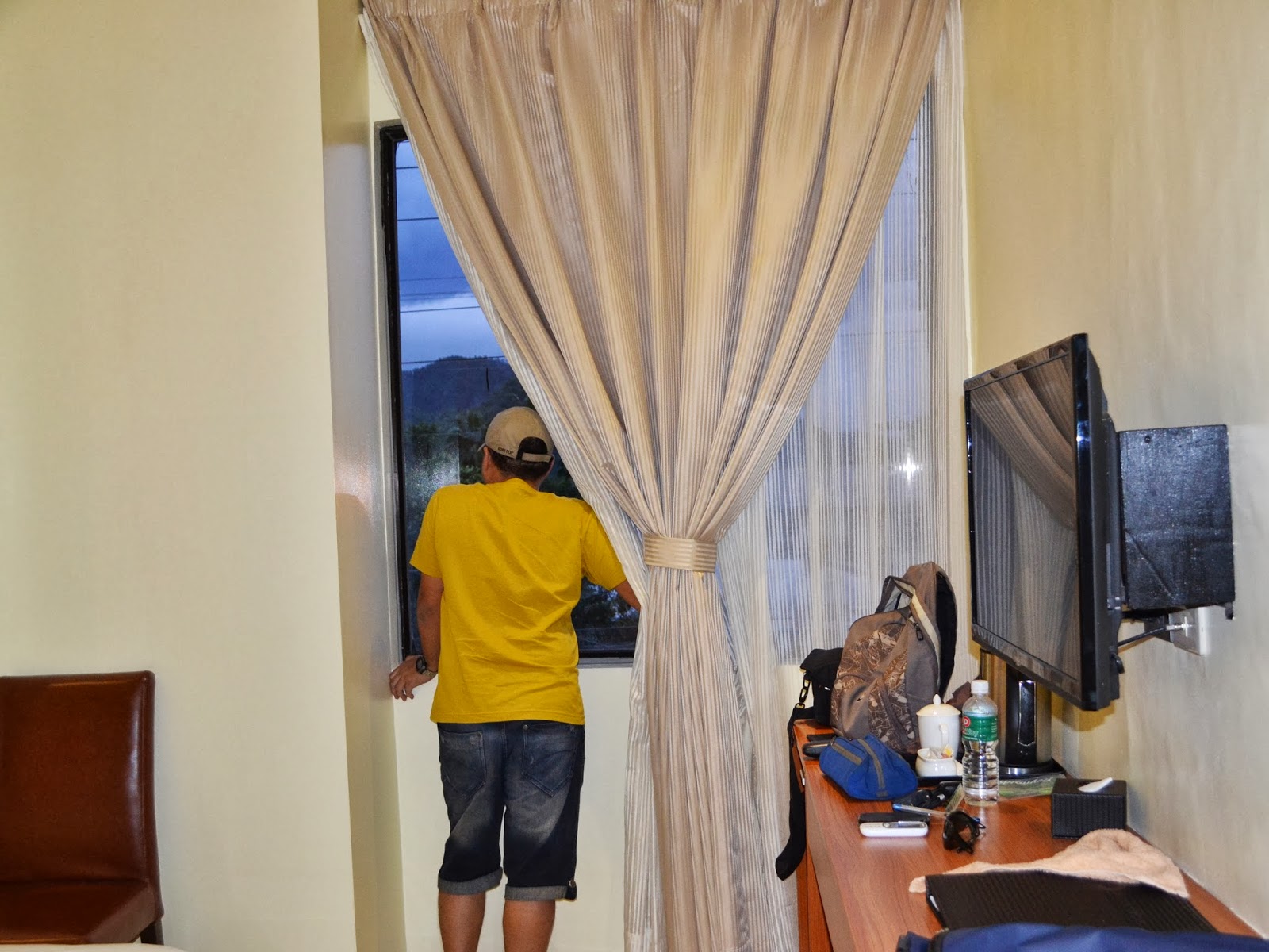

No comments:
Post a Comment